O‘ahu’s Waiʻanae and Ko‘olau volcanoes have an older sibling.
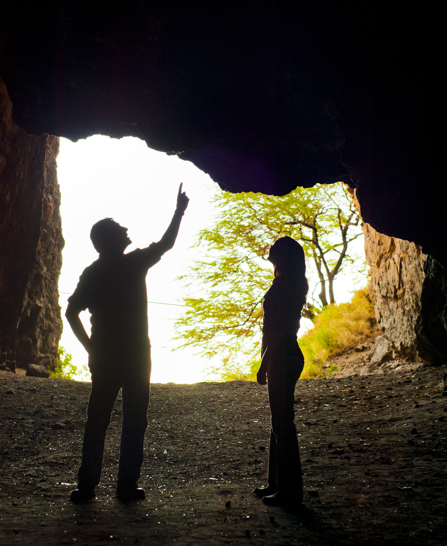
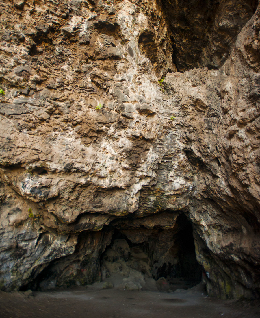
Kāneana has many stories to tell. According to legend, the 100-foot-tall, 450-foot-deep cave named for Kāne, the Hawaiian god of creation, is where humankind first emerged from the womb of the earth goddess Haumea. Later, Nanaue, a half-shark, half-human shapeshifter, lured his victims into Kāneana, where he would devour them in the cave’s deepest, darkest corners. The demigod Māui is said to have resided there along with his grandmother. Another part-time resident of the cave was Haumea’s hotheaded daughter, the fire goddess Pele. But Kāneana has another story to tell, this one encoded in its rocks and being slowly retold, not in the language of myth and legend, but of science.
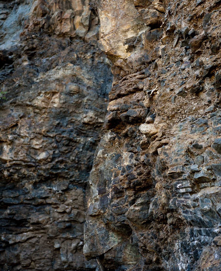
John Sinton and Deborah Eason are among those researchers telling Kāneana’s geological story—a story carved out of the mountainside by hundreds of thousands of years of pounding surf, exposed in the dike rock for scientists to read. According to Sinton, Kāneana’s dike complex indicates that this area was once a major eruption center for the Waiʻanae volcano, which rose from the ocean about 4 million years ago and stretched from Kāneana to Kapolei nearly 20 miles away. “What’s unusual about Kāneana is that its dikes run so parallel to one another,” Sinton says. What’s also unusual is that the pattern seems isolated: “Further south in Nānākuli,” which was another eruption center, “the dikes have a radial orientation; they run all over the place. For 25 years we’ve wondered: Why is Waiʻanae volcano so different from one end to the other?”
To understand why that question is important, you need to know a little about how the Hawaiian Islands—and O‘ahu in particular—formed. All of Hawaiʻi’s islands were born from the same “hot spot,” a place where magma rises from the core to the surface of the Earth. As the Earth’s crust moves—in the case of Hawaiʻi, the Pacific Plate, which is drifting to the northwest at a rate of 5 to 10 centimeters a year—new volcanoes punch through the crust and create islands. Volcanic activity ebbs the farther an island drifts from the hot spot. As it moves away, the volcano erodes, with parts of it falling into the sea.
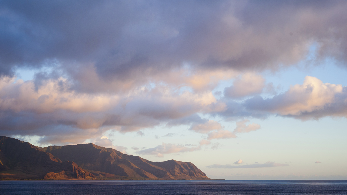
The farther southeast along the Hawaiian chain one goes, the younger the volcanoes are. The Hawaiian hot spot forms shield volcanoes, which have gently sloping flanks like those you can see on Mauna Kea and Mauna Loa on the Big Island today. At one point in history, it was believed, O‘ahu had two such shield volcanoes: the Waiʻanae (3 to 4 million years old) and the Ko‘olau (2 to 3 million years old). Today the remnants of those volcanoes can be seen in the jagged profiles of the Waiʻanae and Ko‘olau mountains, with the broad saddle of Wahiawā between them.
That seems like a fairly straightforward creation story: Two volcanoes formed one after the other as the plate moved over the hot spot and remained connected. But as the features in Kāneana suggest, the story couldn’t be that straightforward. Sinton, who has been studying Waiʻanae volcano since 1979, was baffled by several nagging mysteries surrounding the leeward coast’s geology. In 2010, for example, researchers found lava in Waiʻanae valley that had a different chemical composition from the surrounding lava. It seemed to have come from nowhere, as if dropped from the sky or spit up from a deeper region of the Earth. “This unusual lava flow presented us with a real enigma,” Sinton says. “We know the lava reflects melting of the deep crust underneath the Waiʻanae volcano, but why is the chemical composition so different?”
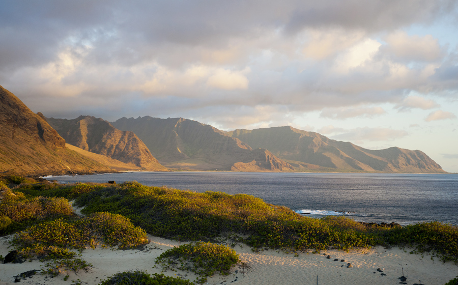
Then there’s the question of leeward O‘ahu’s puzzling topography: The dry leeward side is where you find O‘ahu’s largest valleys, but this is an anomaly, Sinton says. Big valleys usually result from erosion, and in Hawaiʻi they are usually found on the windward sides of islands, where rain falls, water flows, and winds rage. Scientists had long surmised that leeward O‘ahu’s expansive valleys, such as those found in Waiʻanae and Nānākuli, were the result of catastrophic landslides. But what could have caused them?
Sinton, an emeritus professor of geology and geophysics at the University of Hawaiʻi at Mānoa’s School of Ocean and Earth Science and Technology, and Eason, a postdoctoral researcher at UH Mānoa at the time, along with researchers from France’s Laboratoire des Sciences du Climat et de l’Environnement and the Monterey Bay Aquarium Research Institute, published a paper in 2013 that answers these and other questions. Using sophisticated underwater mapping technologies and extensive geological sampling of the ocean floor, the team confirmed the existence of a third O‘ahu volcano, one that predated the Waiʻanae volcano by about 1 million years and Ko‘olau by approximately 2 million; both the Waiʻanae and Ko‘olau volcanoes formed on its flanks.
They named this new submarine volcano Kaʻena. And it’s huge, at least as big as the Ko‘olau volcano: It extends more than 60 miles from Kaʻena Point, almost two-thirds of the way across the Ka‘ie‘ie channel to Kaua‘i. “We always thought that O‘ahu was a two-volcano island. This thinking, of course, reflected the fact that we didn’t have very good maps of the offshore region,” Sinton says. “We basically had only the islands to work with. As the data came in, we would look at these new maps and think, ‘Whoa, that doesn’t look right,’ but we had nothing that could confirm our suspicions.”
The existence of this older submarine volcano explains the leeward coast’s geological mysteries. For instance, as Waiʻanae volcano erupted, it ran headlong into Kaʻena, which likely forced the younger volcano’s dikes into straight lines. The leeward coast’s landslide activity can also be partially explained: According to Sinton, it’s common for volcanoes built on the flank of precursor volcanoes to collapse. Hawaiʻi Island’s Kīlauea, which is currently “failing,” pouring its lava south, sits on the southeast flank of Mauna Loa. For Waiʻanae, most of its landslide activity occurred on the southwestern side, falling away from Kaʻena. And those unusual rocks in Waiʻanae? It turns out that they didn’t appear out of nowhere; they share the same chemistry as the undersea rocks sampled from Kaʻena.
But for Sinton, the discovery of a new volcano raises as many questions as it answers. For instance, it appears that Kaʻena had an unusually prolonged history as a submarine volcano, only breaching the ocean surface late in its history. Once above water, the volcano stood about 3,000 feet above sea level—about the same height as Lāna‘i stands today—before it subsided into the ocean. Sinton estimates that Kaʻena broke the surface about 3.5 million years ago, but when did it re-submerge and why? “We’ve only excavated and mapped a fraction of the area, just scratched the surface,” Sinton says. “There are other things that we want to know about Kaʻena volcano.”
For someone whose research has overturned long-held theories about O‘ahu’s geology, Sinton is circumspect, hesitant to use the word “discovery” to describe his team’s findings. To him it seems more like a confirmation. He says that the leeward coast is a geologist’s dream: Ancient landslides exposed a million years of volcanic history, stacked layer upon layer like an enormous wedding cake. The arid conditions ensured that the rock remained beautifully exposed and accessible. Sinton recalls that as a young researcher he would trek throughout the area, often hiking Waiʻanae’s 4,000-foot Mount Ka‘ala and collecting reams of data along the way. In hindsight he wonders why it took him so long to theorize that there might be a third volcano somewhere under the sea.
“Ko‘olau is wetter, steeper, and more dangerous because the rock is weathered and brittle. Waiʻanae, on the other hand, is a beautiful place to work. As a result, it’s one of the bestmapped volcanoes in the Hawaiian chain,” Sinton says. “So maybe I should have been thinking more about the offshore regions. However, like most people, when I looked out at Kaʻena Point, all I saw was a beautiful ocean.”